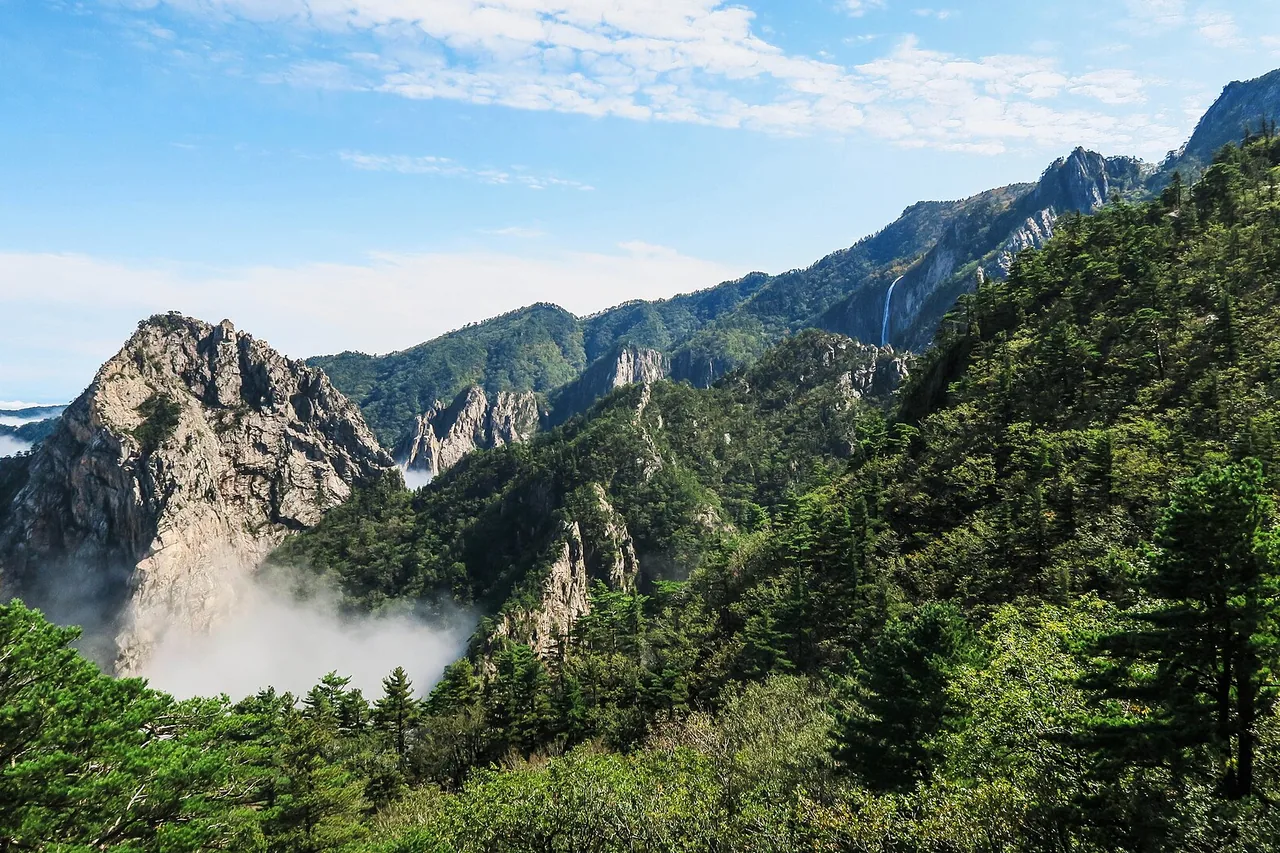
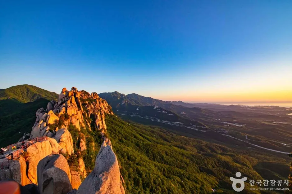
South Korea is mostly mountain, the trails are signposted and busy, and walking into a national park costs nothing. Three things catch foreign hikers out anyway. Whole mountains shut for weeks in spring and again in late autumn for fire prevention. One of the three big summits needs a reservation booked a month in advance. And every trail has a cut-off time, after which staff turn you back at a control post regardless of how fit you are or how far you have come. Those three come first below, then the practical part: which of the mountains in Korea to pick, how to reach it without a car, and what to carry.
Highest mountainHallasan — 1,947 m
Easiest from SeoulBukhansan — by subway
Park entrance feeNone
Reservation neededHallasan summit only
Last checked 2026-08-06 · Korea National Park Service (knps.or.kr) · Hallasan National Park and the Hallasan reservation system (jeju.go.kr/hallasan, visithalla.jeju.go.kr) · Korea Forest Service open data · Korea Meteorological Administration climate normals
Quick answer — The three mountains in Korea covered in full here are Bukhansan (836 m, inside Seoul, about 4.2 km and 2 to 3 hours return to the summit), Seoraksan (1,708 m, roughly 2.5 hours by express bus from Seoul to Sokcho, 10 km and 8 hours return on the shortest summit route) and Hallasan (1,947 m, on Jeju, 9.6 km one way). There is no entrance fee to a Korean national park, abolished in 2007, and only the Hallasan summit sections need a reservation. The two things that decide whether your day happens at all are the spring and late-autumn fire-prevention closures and the entry cut-off times, which apply on every trail.
⚠ Two things to check before you book flights 1. Fire-prevention closures. Korea closes mountain trails for weeks at a time in spring and again in late autumn. The national spring fire-prevention period ran 20 January – 15 May in 2026, and on Seoraksan all 11 sections leading to the summit were shut 4 March – 15 May, with a second closure 15 November – 15 December. Every park publishes its own dates and they are not the same. 2. Entry cut-off times. Trails have a fixed hour after which nobody is admitted: 12:00 in summer on the shortest Seoraksan summit route, 12:30 on the Hallasan summit trails. Arrive after it and you are turned back, reservation or not.
Which of the mountains in Korea should you hike?
Almost every foreign hiker ends up on one of three: Bukhansan, which is a national park inside Seoul; Seoraksan, the rugged one on the east coast; and Hallasan, the highest mountain in the country, on Jeju island. They are not interchangeable. Bukhansan is a subway ride and half a day. Seoraksan is an overnight trip with a long day's walking. Hallasan needs a flight, a reservation booked a month ahead, and a 05:00 start.
Bukhansan — 836 m, Seoul
Getting there: subway only, roughly 40–70 minutes from central Seoul. Summit: Baegundae, about 4.2 km return, 2–3 hours. Hard part: bare granite near the top where you pull on steel cables. Reservation: none. Cable car: none. Bukhansan guide ›
Seoraksan — 1,708 m, Gangwon
Getting there: express bus to Sokcho, about 2.5 hours from Seoul, then a city bus. Summit: Daecheongbong, shortest route 10 km and about 8 hours return from Osaek. Hard part: steep stone steps, over 1,300 m of height gain in 5 km. Reservation: none for the summit trails. Cable car: yes, but it goes to a viewpoint, not the summit. Seoraksan guide ›
Hallasan — 1,947 m, Jeju
Getting there: a flight to Jeju, then bus #281, about 30 minutes from Jeju Bus Terminal to the Seongpanak trailhead. Summit: Baengnokdam crater lake, 9.6 km one way and about 9 hours return via Seongpanak. Hard part: the distance, not the gradient. ★ Reservation: required for the summit sections. Cable car: none. Hallasan guide ›
Short options on the same mountains
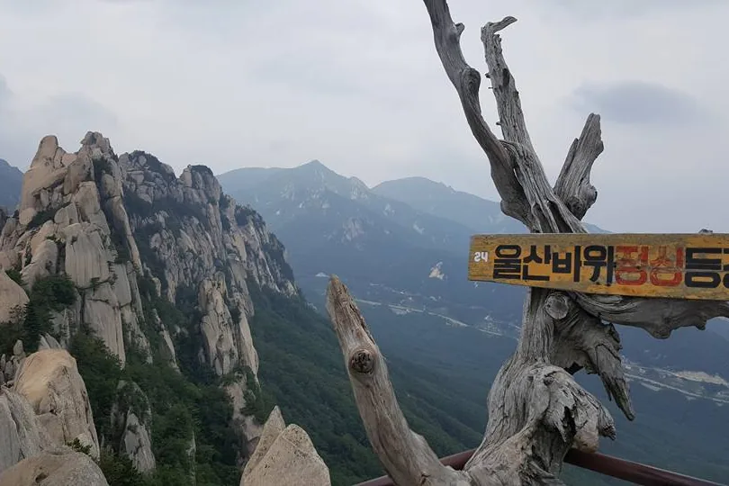
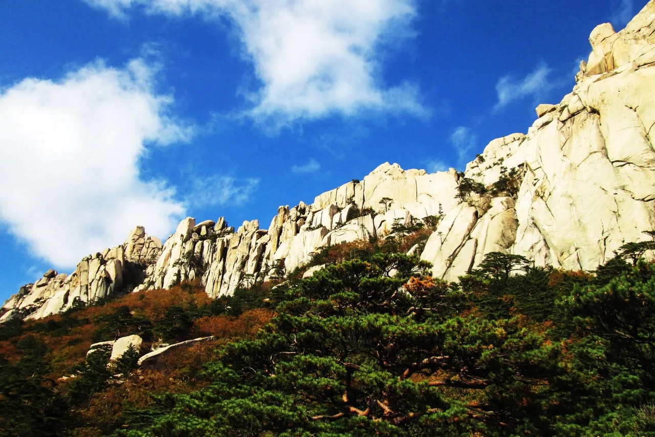
Seoraksan: Ulsanbawi Rock, a separate short objective from the park entrance. Hallasan: the Yeongsil Trail, 5.8 km and 2h30 one way, no reservation — but it does not reach the summit.
If you have one day and you are based in Seoul
Bukhansan. It is the only one of the three you can do on a whim, and Baegundae is a real summit rather than a consolation.
If you want the biggest day
Seoraksan. Nothing else in South Korea has terrain like it, and it turns colour first in autumn.
If you want the highest point in the country
Hallasan — and book it on the first business day of the month before you go.
Autumn, most Korean hikers will tell you, and they are right. The more useful question is which weeks are closed. Spring and late autumn both carry fire-prevention closures that can shut a summit outright; the rainy season closes valley trails at short notice; and winter is a genuine season here rather than an off-season, with equipment requirements to match.
★ Spring — March to May
The fire-prevention closure is the trap. The national spring fire-prevention period ran 20 January to 15 May in 2026. On Seoraksan all 11 sections to Daecheongbong were shut 4 March – 15 May, so the summit was simply not available; only the area around the park entrance and Ulsanbawi Rock stayed open. Bukhansan lost one section on the Dobongsan side (3 March – 15 May) and Baegundae was not affected. Each park publishes its own dates each year. For flowers, Hallasan has dwarf azaleas from late April to early May and royal azaleas from mid-May to mid-June, on the Yeongsil and Eorimok trails rather than the summit trails.
Summer — June to August
The rainy season, jangma, falls in here: the Korea Meteorological Administration's 1991–2020 normals put it at roughly 25 June to 26 July in the central region, but the actual dates move every year and are announced each season. Valley trails close immediately in heavy rain, and typhoons close whole mountains. It is also hot and very humid at low altitude. Two things go in summer's favour: entry cut-offs are later than in winter, and the forest sections are shaded.
Autumn — September to October
The best hiking weather of the year and the busiest. Seoraksan turns first: in an average year the colour starts on Daecheongbong in late September and peaks in Cheonbuldong Valley in mid-October. Those are averages, not a forecast. Expect the heaviest crowds of the year with them — the Sogongwon car park fills before dawn and shelter places go fast. Note that from October the Hallasan winter cut-off times may already apply.
★ Late autumn — mid-November to mid-December
The second fire-prevention closure. On Seoraksan in 2026 that is 15 November – 15 December, with every route to Daecheongbong shut. If you are planning a late-autumn trip specifically for a summit, check the dates for that park before anything else.
Winter — December to February
Snow and rime ice, and the busiest period on Hallasan. Crampons are not optional on any of these three. Hallasan's official winter notice lists crampons and a headlamp as required equipment; on Bukhansan the granite summit slabs hold ice long after Seoul has thawed; on Seoraksan crampons, gaiters and insulated gloves are the minimum and closures for snow depth and wind are frequent. Entry cut-offs are an hour earlier than in summer and the light goes early.
For almost everything, no. Korea does not run a general permit system for hiking, and the two mountains most visitors ask about, Seoraksan and Bukhansan, need nothing booked to walk to the summit. Hallasan is the exception, and it is the one that ruins trips. The summit sections of its two summit trails are on a booking system, the QR code is checked at a control post partway up, and the quota for a popular date is gone within the day it opens.
★ Hallasan summit — reservation required
Two stretches only: Jindallaebat to Baengnokdam on the Seongpanak Trail, and Samgakbong to Baengnokdam on the Gwaneumsa Trail. Book at visithalla.jeju.go.kr, which has an English interface. Booking opens at 09:00 on the first business day of each month, for the whole of the following month. Maximum 4 people per booking. Daily quota 1,000 on Seongpanak, 500 on Gwaneumsa.
How the Hallasan booking actually works
The entry and descent QR codes are sent by SMS to the number you enter, so give a number that will work in Korea. Staff scan the QR and check ID at the control post. If you do not turn up and do not cancel, you are blocked from booking for 3 months on a first offence and a year on a second.
The rest of Hallasan — no reservation
Walking up to Jindallaebat Shelter (7.3 km), up to Samgakbong Shelter (6 km), out to the Sara Oreum viewpoint, or along the Yeongsil, Eorimok, Donnaeko, Eoseungsaengak and Seokguram trails needs nothing booked. None of those reach the summit.
Seoraksan — no reservation
Not for Daecheongbong by any route. Only two things are booked: shelter places, first-come at reservation.knps.or.kr, and the Gombaeryeong section on the Jeombongsan side of the park, capped at 350 people a day.
Bukhansan — no reservation
Not for Baegundae or any of the main routes. The single exception in the park is Uiryeong-gil, between Ui-dong and Gyohyeon-ri, which runs on a reservation system and requires ID.
There is no entrance fee to a Korean national park. Park entrance fees were abolished in 2007, and the separate cultural-property fee that temples inside the parks charged (4,500 KRW at Sinheungsa on the Seoraksan side, for example) was abolished in May 2023. Walking in costs nothing. Parking, cable cars, shelters and campsites are all charged separately.
Entrance fee
None, on all three. Abolished 2007; temple cultural-property fees abolished May 2023.
Parking — Seoraksan
Park-run car parks, small vehicles: 4,000 KRW on weekdays, 5,000 KRW at weekends and in peak season (1 July – 31 August and 1 October – 15 November).
Parking — Bukhansan
Bukhansanseong car parks 1 and 2: 2,000 KRW for the first hour, then 300 KRW per 10 minutes on weekdays and 400 KRW at weekends, or 13,000 KRW for a full day of 9 hours or more.
Parking — Hallasan
Charged by time since January 2026: small vehicles 1,000 KRW for the first hour, then 500 KRW per 20 minutes, maximum 13,000 KRW a day. First 30 minutes free.
Cable car
Only Seoraksan has one: Gwongeumseong, 16,000 KRW return for adults and 12,000 KRW for children, no one-way ticket, no booking, sold on the day at the ticket office only. It reaches about 800 m — not the summit.
Entry cut-off times — the rule visitors have never met before
Korean parks do not simply open and close; they set an hour after which nobody is admitted to a given section, and a later hour at which staff clear people off the summit and send them down. Both are enforced at control posts on the trail, not just at the trailhead. This is why a mid-morning start that would be perfectly normal in Europe or the United States does not work here. You can be turned back two hours into a walk.
Hallasan
Every trail opens for entry at 05:00, daily. Entry cut-off on the two summit trails: 11:30 in winter, 12:30 in summer. Yeongsil and Eorimok 12:00 / 15:00; Donnaeko 10:00 / 11:00. Staff clear the summit at 13:30 / 14:30.
Seoraksan
Osaek to Daecheongbong admits hikers 03:00–12:00 from April to October and 04:00–11:00 in winter. Biseondae to Yangpok is 03:00–14:00 in summer. The 03:00 opening is why the Osaek route is the standard sunrise walk.
Bukhansan
We could not confirm a published entry cut-off time for the Baegundae route from an official source, so we do not quote one. What is certain is that trails close outright in bad weather at short notice. Call the park office on +82 2-909-0497 if the timing matters to your plan.
Where to check on the day
Korea National Park Service closure information for Seoraksan and Bukhansan; the real-time trail status at www.jeju.go.kr/hallasan for Hallasan. Add the Korea Meteorological Administration mountain forecast in winter and typhoon season.
You do not need to drive to any of the three. Bukhansan is a subway ride; Seoraksan is an express bus and a city bus; Hallasan is a flight and a local bus. The one thing to settle before you start walking is the last bus back, because trailhead services thin out in the evening and taxis are not always waiting.
Bukhansan — for Baegundae
Bukhansan Ui Station on the Ui LRT, exit 2, then walk. No bus needed. For the fortress wall route: Gupabal Station (Line 3) exit 1, then bus 704. For the quiet Jeongneung side: Gireum Station (Line 4) exit 3, then bus 143 or 110B.
Seoraksan — from Seoul
Express bus to Sokcho from Dong Seoul Bus Terminal or the Express Bus Terminal at Gangnam, about 2.5 hours, running frequently. From Sokcho, city buses #7 and #7-1 to Seorakdong for the park entrance. For the Osaek trailhead, an intercity bus from Sokcho or Yangyang over Hangyeryeong.
Hallasan — on Jeju
Everything runs from Jeju Bus Terminal. Seongpanak (the summit trail): bus #281, about 30 minutes. Eorimok: #240, about 35 minutes. Yeongsil: #240, about 50 minutes. Gwaneumsa has no direct bus. Jeju's network is reorganised often — check bus.jeju.go.kr on the day.
Paying for it
A rechargeable transport card works on subways and city buses nationwide and is the simplest way to pay. Express and intercity buses between cities are booked or bought separately.
Bus numbers on all of these routes have been reorganised before and can change again. If a number does not match the stop sign, check a live transit app before boarding rather than guessing.
Affiliate link — you pay the same price, and a small commission helps keep Sandogam running.
What to bring, and what the rules are
The single most common mistake is assuming you can buy water on the way up. You cannot. Nothing is sold on the mountain on any of these three: Hallasan's two high-altitude shops at Jindallaebat and Witse Oreum closed in January 2018, and Bukhansan's Baegunsanjang shop stopped trading in 2019. Shelters are somewhere to sit and eat, not somewhere to buy. Buy your water and food before you start walking.
Water
At least 1.5 L for a half day, more for a summit day of 8–10 hours. Refill points are few and some springs dry up in the dry season.
Footwear and gloves
Boots or shoes with real grip. Gloves are worth carrying anywhere with cable or chain sections — on Bukhansan's summit approach you hold on to the rock.
Crampons
Winter, every time. On all three mountains they are treated as required rather than optional, and on Hallasan a headlamp is listed alongside them in the official winter notice.
Headlamp
Early starts are normal here. Seoraksan's Osaek route opens at 03:00 and Hallasan's trails at 05:00.
Rain shell
Summer, always. Valley trails close on heavy rain, and the weather changes fast above the treeline.
Offline map
Junction signs are mostly in Korean and the romanisation of peak and gate names is inconsistent between signs. Load the route onto your phone before you set out; signal in the valleys is unreliable.
The rules are set by the Natural Parks Act and enforced with on-the-spot fines. Cooking or camping outside designated places, smoking outside designated areas, drinking alcohol at shelters and other designated spots, littering, and entering closed sections are all offences. Cooking outside a designated place and littering each carry a 100,000 KRW fine on a first offence; the published schedules for the smoking and alcohol penalties disagree with each other, so we do not quote those amounts. Carry your rubbish out. Bins were removed from Korean trails long ago and there is nowhere to leave it.
Hallasan adds rules of its own: eating is allowed in the shelters but not at the summit itself, and self-heating lunch boxes are permitted while heat packs used for cooking in a pot are not.
Trail difficulty in Korea — low mountains, steep trails
The numbers make Korean mountains look easy. Bukhansan's summit is 836 m; Seoraksan's is 1,708 m; the highest point in the whole country is 1,947 m. Nothing here is at altitude and nothing needs technical equipment on a normal walking route. What the numbers hide is the gradient. Korean trails tend to go straight up, and the ground is granite, so long sections are stone steps, steel steps and bare slab rather than a graded path.
Look at what that means on the ground. The shortest route up Seoraksan, from Osaek, is 5.0 km with over 1,300 m of height gain, and the official time for it is 4 hours one way, because it is steep stone steps almost from the first minute. On Bukhansan the last stretch to Baegundae crosses open granite where steel cables and handrails replace the path and you pull yourself up; it needs no equipment and no experience, but you use your hands and there is drop below you. At the other end of the scale, Seoraksan's Dinosaur Ridge traverse is 19.1 km and 14 hours 40 minutes of scrambling with no easy escape once you are committed, and it is normally done with a night in a shelter rather than in a day.
None of that makes Korean hiking dangerous, and you will be passed by people twice your age on any of it. But do not read a low summit figure as a short easy day, and do not read a busy trail as an easy one. If exposure bothers you, the alternatives are real: the fortress wall route on Bukhansan has no cable work at all, and Hallasan's Yeongsil Trail is the best scenery on the mountain without going near the summit.
Closure notices, live trail status, bus times and the Hallasan reservation QR all arrive on your phone. Coverage in the valleys is patchy, so download the route before you go.
Jeju, 1,947 m — the highest mountain in South Korea. Which of the five trails actually reach the summit, how the reservation works, and the start and cut-off times.
The shortest and most scenic route on Hallasan, 5.8 km and 2h30 one way, with no reservation needed. It does not reach the summit, and that is the point.
Gangwon, 1,708 m — the most rugged national park in the country. Three routes to Daecheongbong, the fire-prevention closures, the cable car, and Dinosaur Ridge.
Bukhansan's summit at 836 m, about 4.2 km return from Ui-dong. The cable section on the granite slabs, the view over Seoul, and the weekend queues.
Frequently asked questions
Q. What are the most famous mountains in Korea? Seoraksan, Hallasan and Bukhansan are the three that most visitors hike. Hallasan on Jeju is the highest point in South Korea at 1,947 m, with a crater lake called Baengnokdam at the top. Seoraksan in Gangwon province is the third-highest at 1,708 m and the most rugged, and it is the first place in the country to turn colour in autumn. Bukhansan is a national park inside Seoul with an 836 m summit, Baegundae, that you reach by subway. Jirisan and many others are well known domestically, but those three are the ones with the most English information and the easiest access.
Q. Is hiking in Korea difficult? The mountains are low but the trails are steep. Nothing on a normal walking route needs technical equipment, and nothing is at altitude; the highest summit in the country is 1,947 m. What catches people out is gradient. The shortest route up Seoraksan gains over 1,300 m in 5.0 km on stone steps, and the final stretch to Baegundae on Bukhansan crosses open granite where you pull yourself along steel cables. Distances are short by international standards; the ground is harder than the figures suggest. Easier alternatives exist on the same mountains: Bukhansan's fortress wall route and Hallasan's Yeongsil Trail have no scrambling at all.
Q. Do I need a permit or a reservation to hike in Korea? For nearly everything, no. Korea has no general hiking permit. The one that matters is Hallasan: the summit sections of the Seongpanak and Gwaneumsa trails require a booking at visithalla.jeju.go.kr, which opens at 09:00 on the first business day of each month for the whole of the following month, with a maximum of 4 people per booking. The QR code arrives by SMS and is scanned at a control post on the trail. Seoraksan needs no reservation for Daecheongbong, only for shelters and the Gombaeryeong section. Bukhansan needs none except for Uiryeong-gil, which also requires ID.
Q. When is the best time of year for hiking in Korea? Autumn, with September and October the strongest months, but check the closures first. Spring and late autumn both carry fire-prevention periods when whole summits shut: in 2026 the national spring period ran 20 January to 15 May, and on Seoraksan every route to the summit was closed 4 March to 15 May and again 15 November to 15 December. Summer brings the rainy season, which the Korea Meteorological Administration's 1991–2020 normals place at roughly 25 June to 26 July in the central region, though the dates move every year. Autumn colour reaches Seoraksan first, starting on the summit in late September and peaking in Cheonbuldong Valley in mid-October in an average year.
Q. Can I hike in Korea in winter? Yes, and it is a proper season rather than an off-season. January and February are the busiest months on Hallasan, for the snow and rime ice. Crampons are treated as required rather than optional on all three mountains here, and Hallasan's official winter notice lists a headlamp alongside them. Compared with summer, entry cut-off times move an hour earlier and closures for snow depth and wind are frequent, so check the trail status on the morning you go. Do not walk alone on snow, and if you have not hiked in Korean winter conditions before, go with someone who has.
Q. Is there an entrance fee for Korea's national parks? No. National park entrance fees were abolished in 2007, and the separate cultural-property fee that temples inside the parks used to charge (4,500 KRW at Sinheungsa on the Seoraksan side) was abolished in May 2023. Walking into the park is free. What you do pay for is parking (4,000–5,000 KRW for a small car at Seoraksan; hourly rates at Bukhansan and Hallasan), the Seoraksan cable car at 16,000 KRW return for adults, and shelter or campsite places if you stay overnight.
Q. Can I get to Korea's mountains without a car? Yes, for all three on this page. Bukhansan is subway only: Bukhansan Ui Station, exit 2, then walk to the trailhead, roughly 40 to 70 minutes from central Seoul. Seoraksan is an express bus from Dong Seoul Bus Terminal or the Express Bus Terminal at Gangnam to Sokcho, about 2.5 hours, then city bus #7 or #7-1 to the park entrance. Hallasan is a flight to Jeju, then bus #281 from Jeju Bus Terminal to the Seongpanak trailhead, about 30 minutes. The one thing to plan is the last bus back, since trailhead services thin out in the evening. Bus numbers are reorganised periodically, so check a live transit app on the day.
Q. What should I pack for a day hike in Korea? Water and food for the whole day, because nothing is sold on the mountain. The high shops on Hallasan closed in January 2018, Bukhansan's closed in 2019, and shelters sell nothing. At least 1.5 L of water for a half day, more for an 8 to 10 hour summit day. Shoes with real grip, and gloves for the cable and chain sections. A headlamp, since early starts are the norm and Seoraksan's Osaek route opens at 03:00. A rain shell in summer, and crampons in winter without exception. Finally, an offline map on your phone: junction signs are in Korean, the romanisation is inconsistent between signs, and signal in the valleys is unreliable.
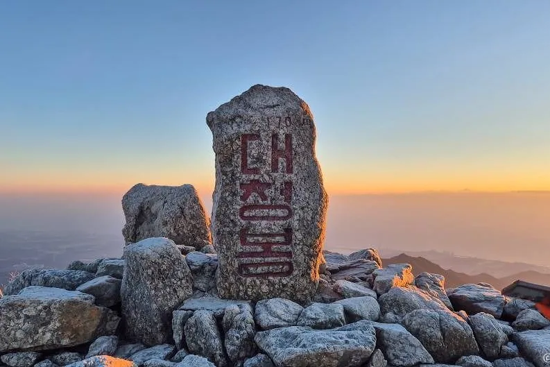
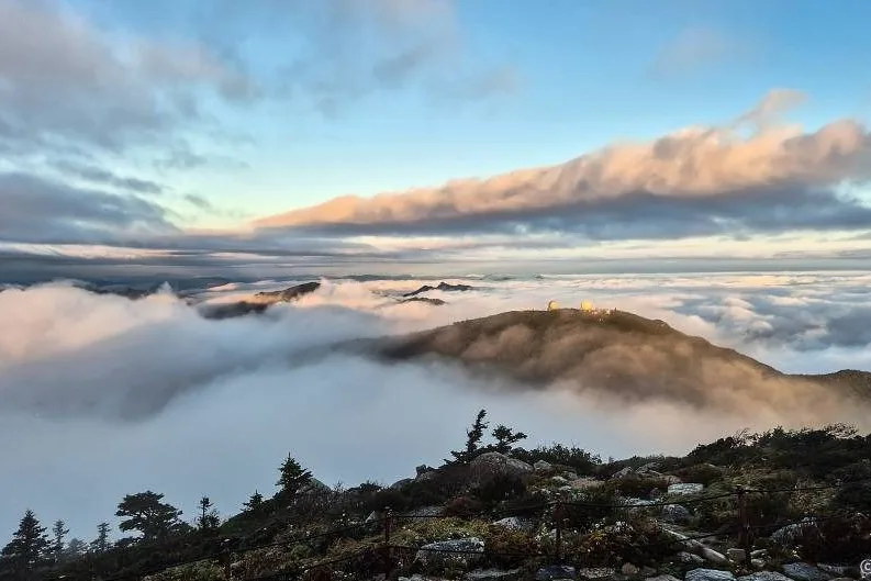
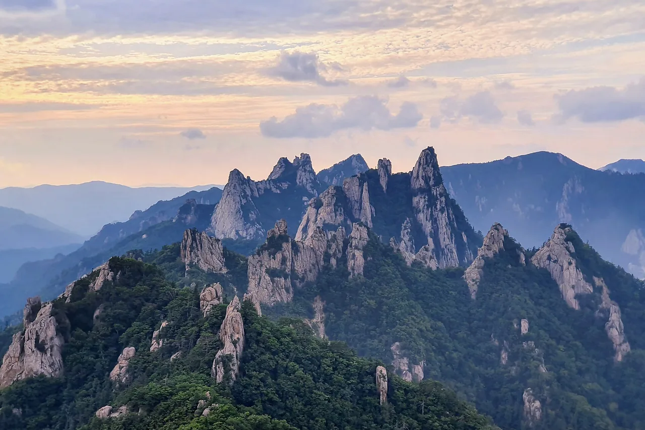
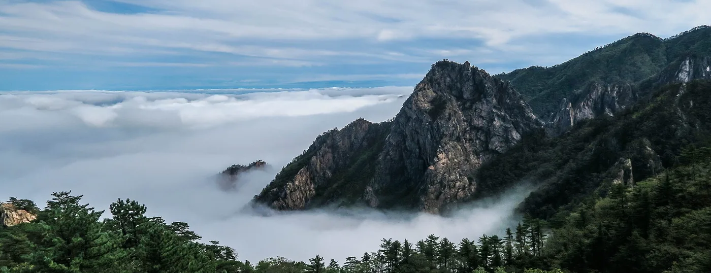 A sea of cloud below the ridges of Seoraksan, the most rugged of Korea's national parks. ©Elananna · CC BY-SA 3.0