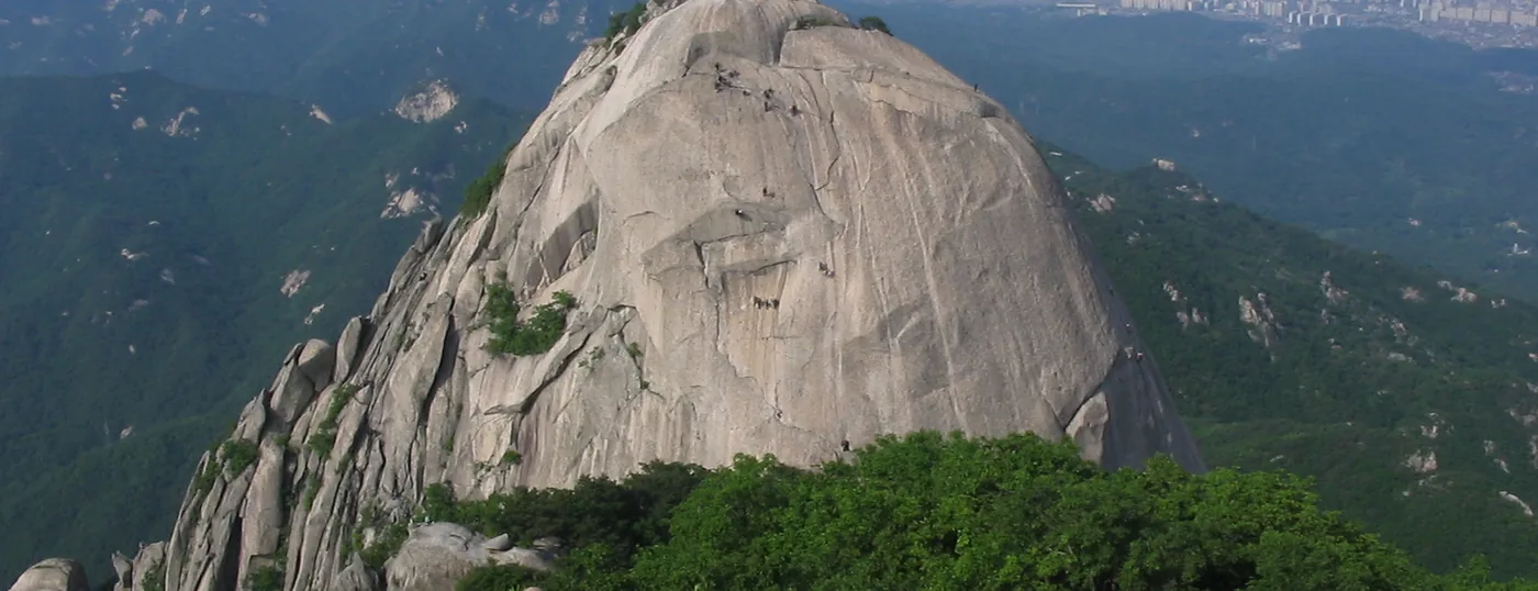
 Insubong seen from the top of Baegundae, with Seoul behind it. The metal railings at bottom right are the last stretch of the trail. ⓒWikimedia Commons · CC BY-SA 3.0Insubong seen from the top of Baegundae, with Seoul behind it. The metal railings at bottom right are the last stretch of the trail. ⓒWikimedia Commons · CC BY-SA 3.0
Bukhansan › Baegundae Peak (836 m)
Baegundae Peak is the summit of Bukhansan, 836 m above Seoul, and the only one of the mountain's three granite peaks with a walking route to the top. The shortest way up is 4.2 km return from Ui-dong and takes 2 to 3 hours. The last stretch is bare rock with steel cables and railings bolted into it, so it stays a walking route but a hands-on one. No reservation is required, and the trailhead is a subway station.
Last checked 2026-08-06 · Korea Forest Service trail geodata · Korea National Park Service · cross-checked against the Korean edition of this page
Baegundae is the high point of Bukhansan National Park, inside the northern edge of Seoul. At 836 m it is the tallest of the three granite peaks that stand together at the top of the massif, alongside Insubong and Mangyeongdae. That trio gave the mountain its older name, Samgaksan, "three-horn mountain".
Of the three, only Baegundae has a trail. Insubong, the pale dome in the photo at the top of this page, is rock-climbing terrain: rope, helmet, no walking route. Mangyeongdae sits between them. So when people talk about reaching the Bukhansan summit, they mean this one peak, and they mean one kind of day out: a short, steep walk that ends on open granite.
For the other approaches, the fortress wall, the trail map and the GPX download, see the full Bukhansan hiking guide.
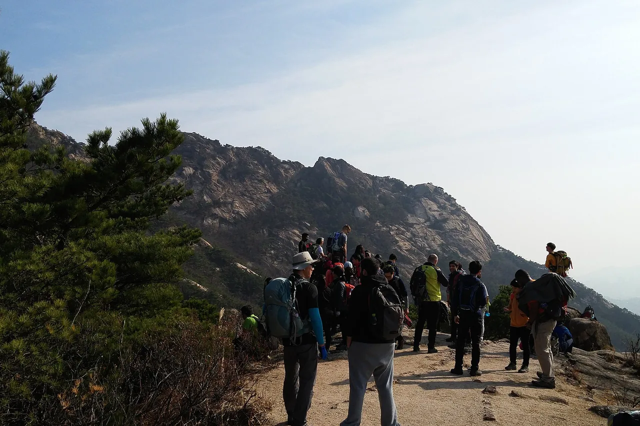
The standard route starts at Bukhansan Ui Station, the terminus of the Ui LRT, and it is the shortest line to the summit from anywhere on the mountain. About 4.2 km there and back, 2 to 3 hours.
There is nothing flat about it. A 4.2 km round trip to an 836 m summit means the climbing is continuous, and the shelter is a place to catch your breath rather than a halfway point in effort. Take gloves; you will be holding cable and rock.
The Baegunsanjang shop, on the way up, stopped trading in 2019 and is now a history exhibit and rest space. Nothing is sold anywhere on this route. Buy water and food before you leave the station.
From the Baegunbong-ammun gate to the summit the trail runs out and the granite starts. Steel cables and handrails are bolted into the slabs, and you pull yourself up them. Baegundae stays a walking route rather than a climb, and it needs no rope, harness or experience. But you use your hands, the rock is smooth, and there is drop below you.
It goes like this: a few short pitches of leaning back on a cable with your feet flat on rock, then a scramble over rounded slabs, then the top. Most people find it more awkward than frightening. People who dislike heights find it genuinely uncomfortable, and there is no shame in stopping at the gate. The view from there is already worth the walk.
In 2024 the park added five more safety railings on the steepest slabs and separated the uphill and downhill lines of travel. That fixed the worst of the two-way congestion, which used to be the real hazard: people passing each other on cable with nowhere to stand.
Insubong comes first and closest, a huge pale dome directly across from the summit, close enough to pick out climbers on it as dots. Mangyeongdae stands on the other side. Beyond the peaks, the whole Seoul basin: the city spreading south under haze, the Han River when the air is clear, and the ridgeline of Dobongsan running north.
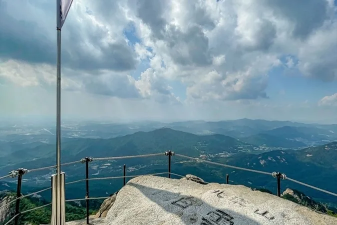
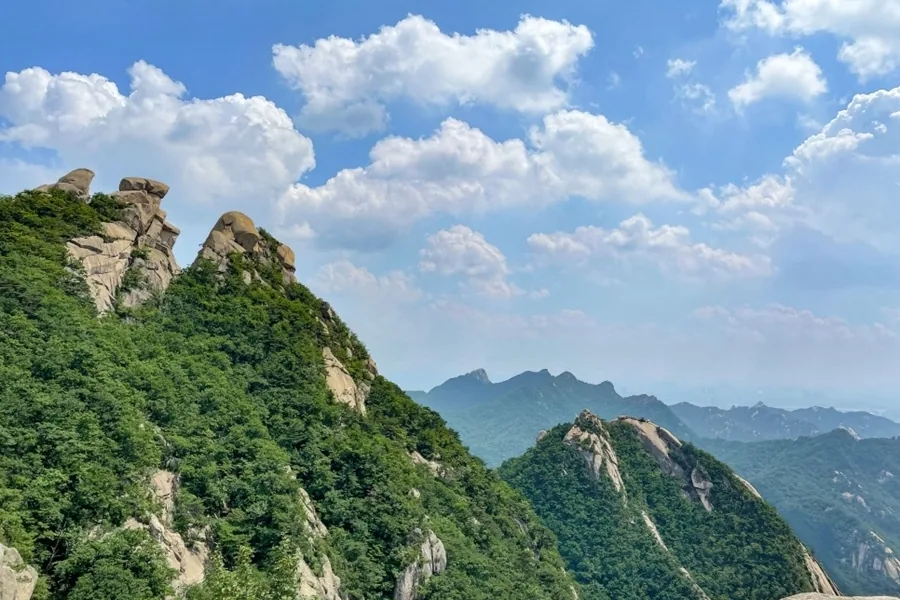
The summit itself is a rounded granite dome with a Korean flag on it and not much room. On a clear autumn weekend there will be a line of people waiting to photograph that flag. Air quality decides how much you actually see. A clear winter day after wind gives the longest view of the year; a humid August afternoon may give you nothing past the near ridges.
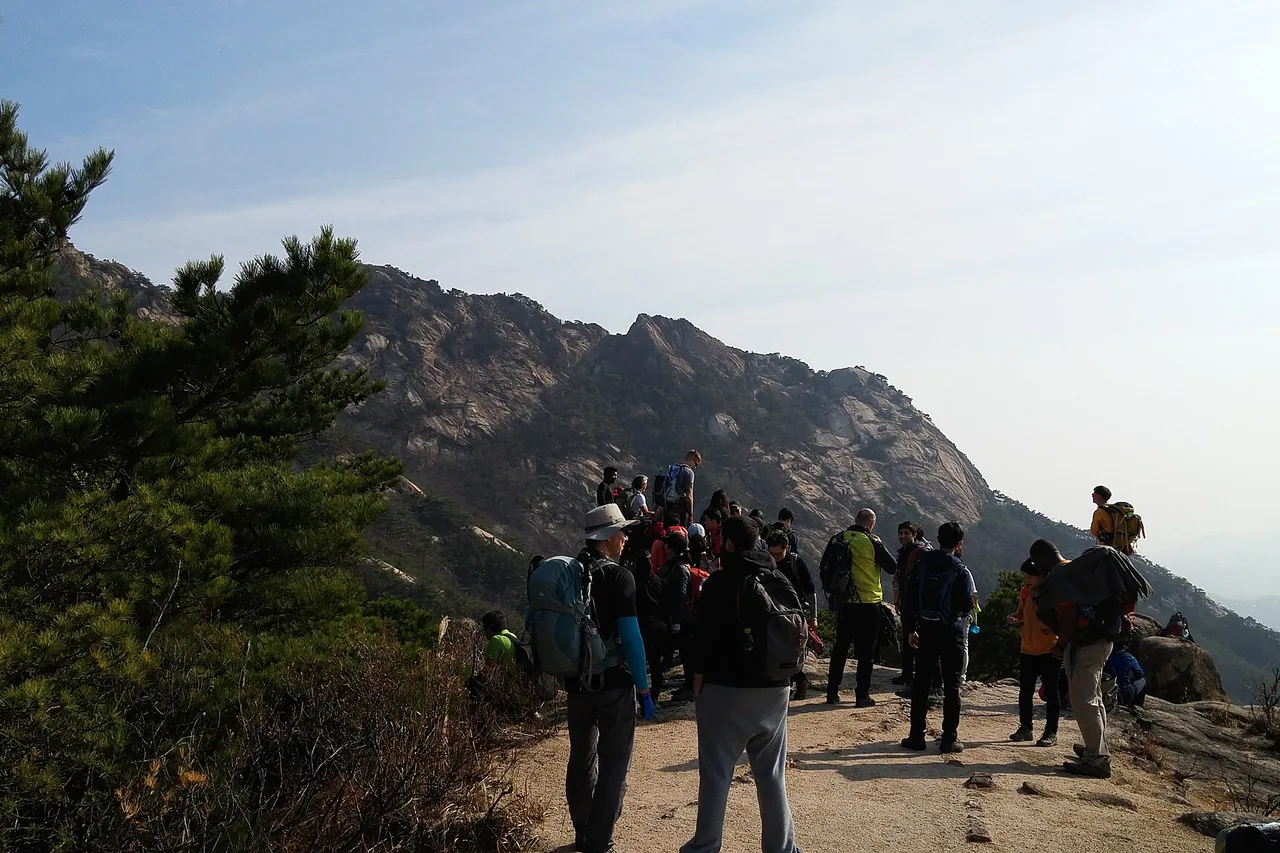
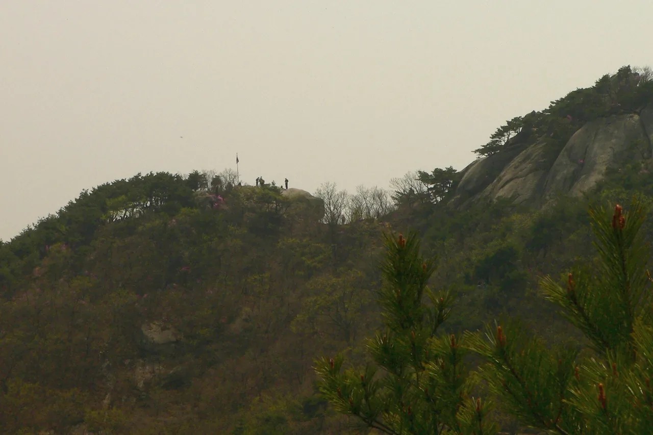
Crowds are the single biggest variable on Baegundae. Weekend mornings in spring and autumn are the peak of the peak, and the cable section becomes a queue. The 2024 railing work made it move, but it is still a queue. If your schedule allows a weekday, take it. If it does not, start early: being on the summit slabs before mid-morning is worth an hour of sleep.
The summit slabs are the problem, not the walk to them. When they ice up, the Baegundae approach turns dangerous, and winter crampons are a requirement rather than a precaution. Ice sits on the top of this mountain long after Seoul's pavements are clear, so bring them even when the city looks fine.
In rain, wet granite plus steel cable is a bad combination on ground where a slip has consequences. The sensible call is to walk to the Baegunbong-ammun gate, look, and come down. Bukhansan is a national park, so in genuinely bad weather the park service closes trails outright. The notice goes up on the Korea National Park Service site, and it is worth checking on the morning you go, along with the Korea Meteorological Administration mountain forecast.
Reservations: none needed for Baegundae as of 2026-08-06. The only trail in Bukhansan that runs on a reservation system is Uiryeong-gil, between Ui-dong and Gyohyeon-ri. Rockfall and weather closures are posted at short notice, so if you want certainty on the day, call the Bukhansan National Park Office on +82 2-909-0497.
One station, no bus. Bukhansan Ui Station is the terminus of the Ui LRT (the Ui–Sinseol light rail line), and the trailhead is a walk from exit 2, up the road toward the Doseonsa temple entrance and the Baegundae trail support centre. Reckon on roughly an hour from central Seoul including the transfer.
Alternative approach to the same side: Suyu Station (Line 4), exit 3, then bus 120 or 153 to the Ui-dong terminus. Useful if you are already on Line 4 and want to skip the LRT transfer. There is paid parking around Ui-dong, but the Bukhansanseong car parks on the far side of the mountain fill early at weekends and this is a mountain most people reach by train.
Bus numbers in this area have been reorganised before. If a number does not match the stop sign, check a live transit app before boarding.
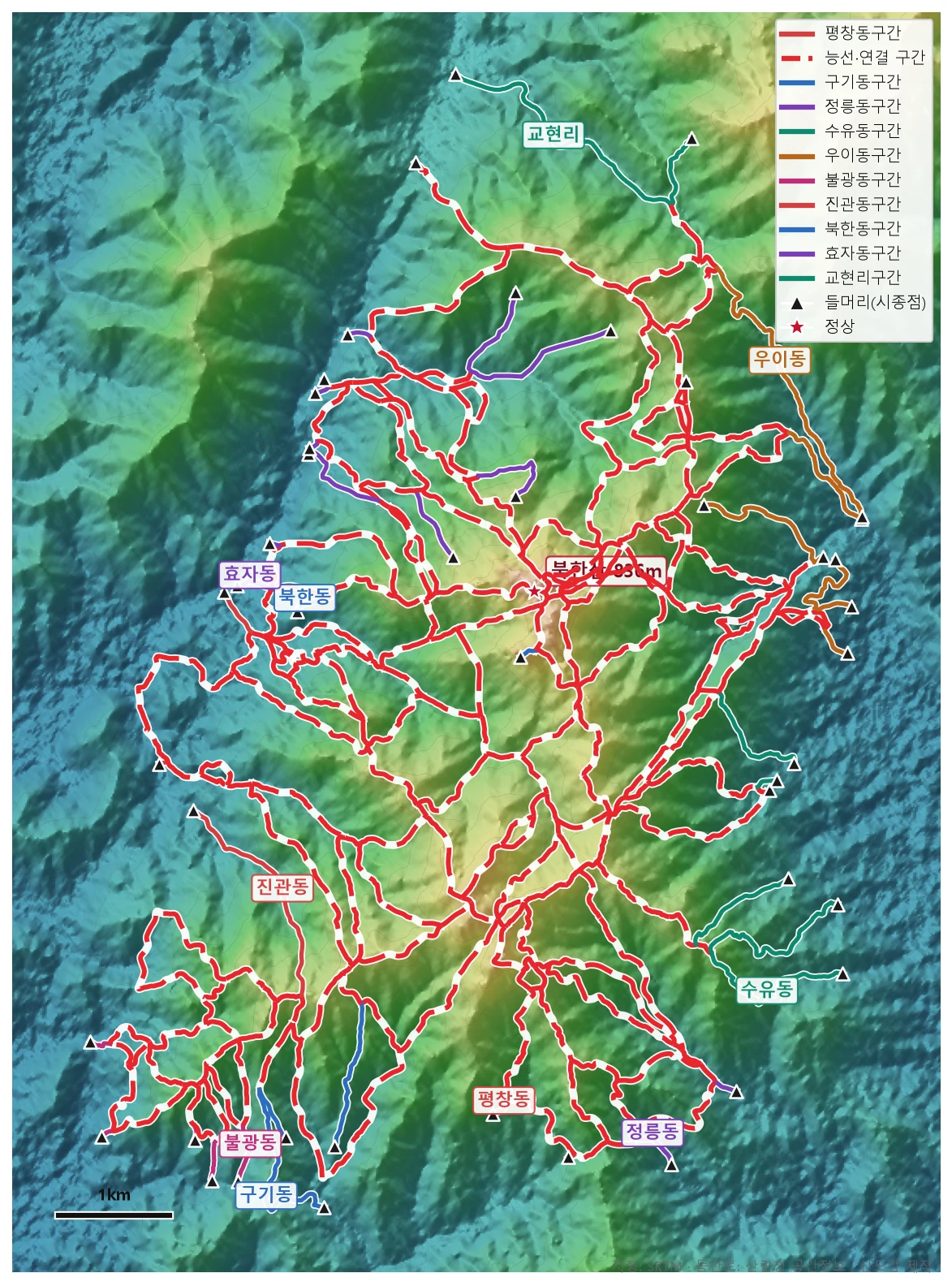
🗺 Open the full-size trail map
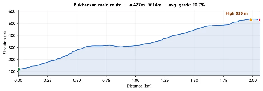
Calculated from SRTM terrain elevation (DEM) over 2.06 km. A moving average and a 4 m threshold are applied to damp GPS noise, so the figures run conservative rather than inflated. This is the mountain-wide profile for Bukhansan, not a track recorded on the Baegundae route specifically. Use it for the scale of the climb, not for turn-by-turn detail. Drawn from the Korea Forest Service trail data by taking the path with the most total climbing, so it is the hard end of what the mountain asks of you. On some mountains the trail data stops short of the summit, so the highest point here can sit below the official summit elevation.
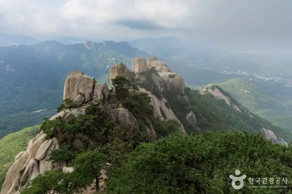
Baegundae is one summit on a park holding 164.9 km of trail across 11 trailhead sections. The Bukhansanseong Fortress wall circuit, the Bibong ridge from Gugi-dong, the quiet Jeongneung valley, the downloadable trail map and GPX, fees and parking are all covered in the full Bukhansan hiking guide. If you would rather not climb at all, the Bukhansan Dulle-gil circles the foot of the mountain in 21 low-level sections with no rock on any of them.
Q. How high is Baegundae Peak?
836 m. It is the summit of Bukhansan and the highest of the mountain's three granite peaks, ahead of Insubong and Mangyeongdae. Neither of those two has a hiking trail; Insubong is climbed with rope and helmet only.
Q. How long does it take to climb Baegundae?
About 2 to 3 hours for the round trip on the shortest route, which starts at Bukhansan Ui Station in Ui-dong and covers roughly 4.2 km there and back. Add time at weekends: the cable section near the summit backs up, and the wait can be significant on an October Sunday.
Q. Is Baegundae dangerous?
It is a normal walking route with one demanding section. From the Baegunbong-ammun gate to the top you cross open granite using steel cables and railings bolted into the rock, so you climb with your hands and there is exposure below you. No equipment or experience is required in dry conditions. In ice, rain or high wind it is a different proposition, and you should not go up in winter without crampons.
Q. Do I need to book to climb Baegundae?
No. There is no reservation system for Baegundae and no entrance fee for Bukhansan National Park, as of 2026-08-06. The one trail in the park that does require booking, and ID, is Uiryeong-gil between Ui-dong and Gyohyeon-ri. Weather and rockfall closures can appear at short notice, so check the Korea National Park Service site on the day or call +82 2-909-0497.
Q. Can I avoid the crowds at the summit?
Go on a weekday, or start early enough to be on the summit slabs before mid-morning. Approaching from the Goyang side, at Hyoja-dong or Gyohyeon-ri, is longer but much quieter than Ui-dong. And if the crowd is the deal-breaker rather than the climb, the fortress wall route on the Bukhansanseong side gives you views over Seoul with a fraction of the traffic.