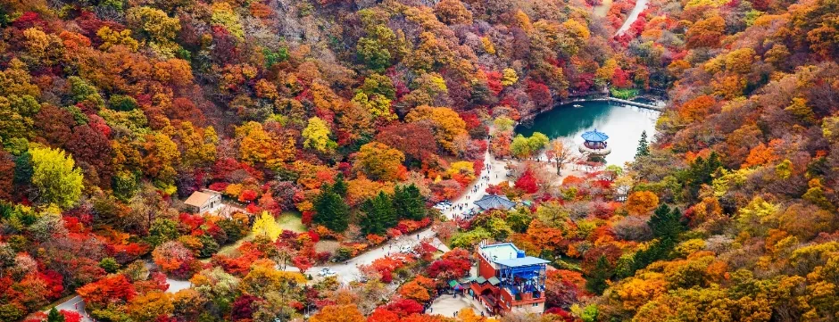
 The inner basin of Naejangsan in autumn. A horseshoe of ridges wraps the valley, with the Uhwajeong pond and the park facilities sitting at its centre. ©Korea Tourism Organization · TourAPIThe inner basin of Naejangsan in autumn. A horseshoe of ridges wraps the valley, with the Uhwajeong pond and the park facilities sitting at its centre. ©Korea Tourism Organization · TourAPI
Naejangsan National Park (Mount Naejang)
Naejangsan is the mountain Koreans drive across the country to see in autumn. It became Korea's eighth national park on 17 November 1971, and a horseshoe of eight peaks — Seoraebong, Bulchulbong, Manghaebong, Yeonjibong, Kkachibong, Sinseonbong, Yeonjabong and Janggunbong — closes a single valley in so tightly that the old name means "the mountain that hides things inside". The Korea National Park Service lists the height as 763 m and the Korea Forest Service as 763.5 m, so the two official figures differ slightly. The thing to plan around is not the climb. It is autumn: in 2025 private cars were barred from the last 2.1 km for three weeks and only a free shuttle ran. On this mountain you decide when and how you get in before you pick a trail.
Last checked 2026-10-31 · Naejangsan National Park Office, Korea National Park Service (knps.or.kr): trail list, course distances and times, parking rates, entry-time rules and peak-season notices · Korea Forest Service (100 Famous Mountains) · Korea Heritage Service: natural monument records
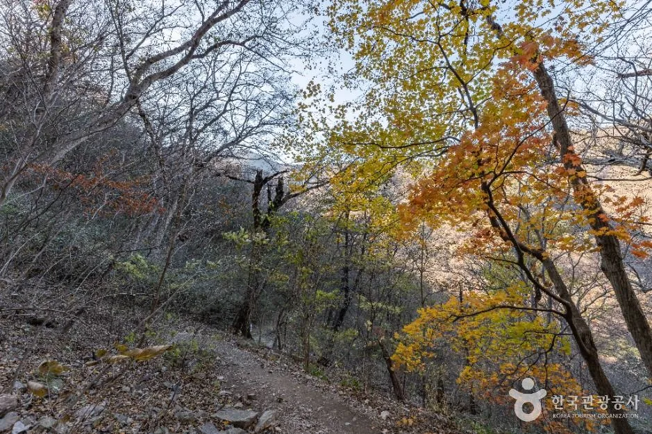
Most Korean mountains are a ridge you walk along. Naejangsan is a bowl. Eight peaks stand in a horseshoe around one valley, open only at the western end where you walk in, and the Korea Forest Service describes the result as a natural fortress. The valley floor holds Naejangsa Temple, the maple tunnel and the Uhwajeong pond; the rim holds the summit. That shape is why the mountain works for two completely different visitors on the same day. You can spend ninety minutes on the flat among the maples and never gain height, or you can spend seven hours walking the whole rim above them.
The high point is Sinseonbong, on the southern arc. Seoraebong, on the northern arc, is the one people photograph: a rock crest named after a Korean harrow because of its row of teeth, and the Forest Service singles out the view of it from Byeongnyeonam hermitage as the finest on the mountain. Administratively the park sits in Jeongeup and Sunchang in Jeollabuk-do, with a separate Baegam district over the provincial line in Jangseong, Jeollanam-do. It is counted among the five great mountains of Honam.
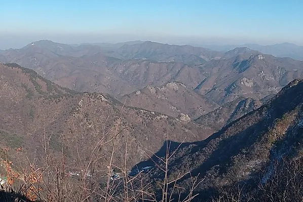
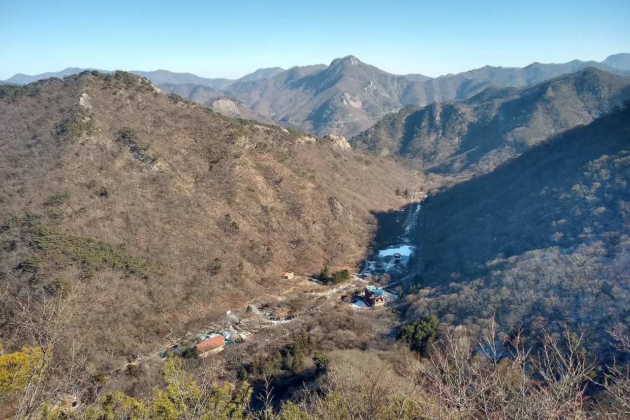
The park service publishes a distance, a time and a difficulty grade for every course in the Naejang district. They divide cleanly into three kinds: walk the whole rim, climb one peak and come back, or stay on the valley floor. The three below are the ones that count as hiking.
The shortest official course is the Observatory Course, 1.81 km · 50 minutes · easy — but only because the cable car does most of it. You ride up from the trail support center, walk to the observatory and come back past the temple. The shortest loop on foot is the Nature Trail Course, 3.9 km · 1h20 · easy: Iljumun gate, Byeongnyeonam, Wonjeogam, Naejangsa Temple, back to the gate. The maple tunnel, the temple and the Daphniphyllum grove all fall inside that one circuit, which is why it is the route most autumn visitors actually walk. Shorter still is the Yonggul Cave Course, 2.3 km · 1h30 return from the gate.
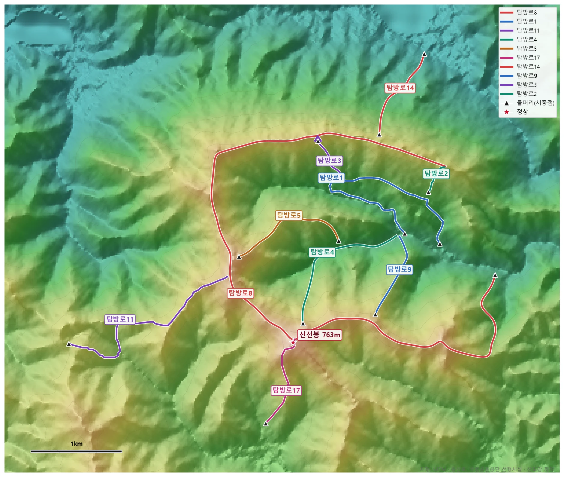
🗺 Open the full-size trail map
Take the map with you. There is a print-quality PDF of this map — vector, so it stays sharp at any zoom — and a GPX track for Naejangsan you can load into a phone app before you lose signal in the valley. Both are free; keep the attribution to Sandogam and use them wherever you like.
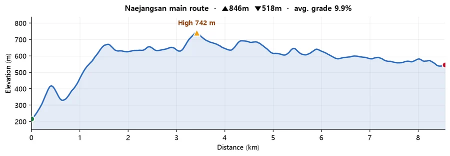
Calculated from SRTM terrain elevation (DEM) over 8.56 km. A moving average and a 4 m threshold are applied to damp GPS noise, so the figures run conservative rather than inflated. Drawn from the Korea Forest Service trail data by taking the path with the most total climbing, so it is the hard end of what the mountain asks of you. On some mountains the trail data stops short of the summit, so the highest point here can sit below the official summit elevation.
Nobody can tell you the peak date in advance, and the park service does not try. It publishes "foliage status" notices once the season is under way, reporting what is actually happening, and in 2018 it went further and told visitors that the peak differs section by section inside the park. Even those notices carry the caveat that the weather on the day changes things. A date like "peak around 10 November" circulating in the press is not a primary source.
What you can use instead are the four peak-season measures the park service announces officially. Overlay them and a window appears. ① Free shuttle bus, 25 Oct – 16 Nov 2025. ② Peak parking-demand period, 1 Oct – 15 Nov. ③ Reservation system for Ipamsan Gatbawi, 18 Oct – 16 Nov. ④ Autumn fire-season trail closure, 15 Nov – 15 Dec. All four cluster in mid-October to mid-November. That is the park service's own judgement about when the crowds come. Plan inside that window and confirm with the current year's notice before you leave.
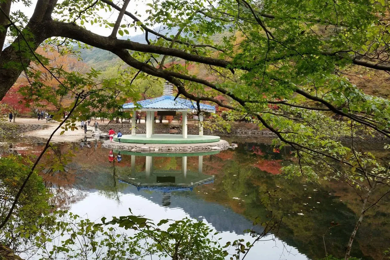
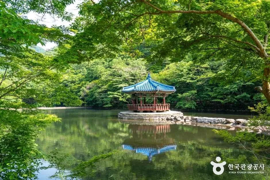
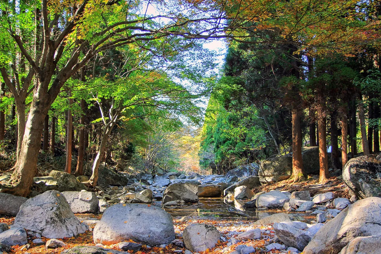
Two places carry the postcard view. The maple tunnel is a straight run of roughly 300 m from the Iljumun gate to Naejangsa Temple, planted with 108 maple trees — 108 for the afflictions counted in Buddhism. Uhwajeong is a pavilion standing in a pond at the park entrance; the name comes from a legend of sprouting wings and ascending to heaven, and the present octagonal-roofed wooden hall replaced a concrete structure in 2016. There is no charge and it is open all year. The right-hand fork in front of Uhwajeong leads straight into the maple tunnel, so treat the two as one short walk.
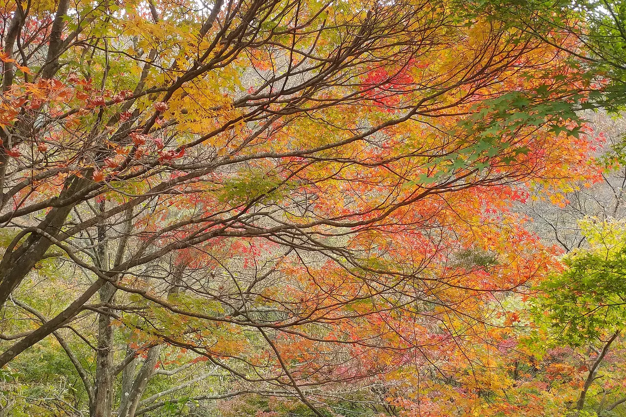
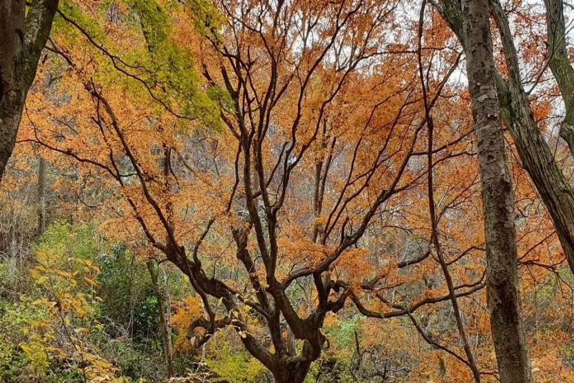
One tree on this mountain is protected in its own right: the Jeongeup Naejangsan Maple Tree, a Natural Monument, roughly 290 years old and 16.87 m tall. Near Wonjeogam there is also a colony of Daphniphyllum macropodum, Natural Monument No. 91, an evergreen broadleaf growing close to its northern limit here.
A discrepancy worth knowing about, because you will meet it in print. The Korea Forest Service description of Naejangsan records the nutmeg forest around Wonjeogam as Natural Monument No. 153. In the Korea Heritage Service register, No. 153 is the nutmeg forest at Baegyangsa Temple in Jangseong, and the protected stand at Wonjeogam is the Daphniphyllum colony, No. 91. This page follows the Heritage Service.
The cable car does not take you to the top. The upper station sits on the flank of Yeonjabong at 540 m, and from there it is about 300 m, ten minutes on foot, to the observation deck. To stand on Sinseonbong (763.5 m) you keep walking along the ridge; the shortest way to the summit under your own power is the Sinseonbong Course, 7.4 km and five hours. The cable-car-assisted Observatory Course is 1.81 km and 50 minutes.
The line opened in August 1980. It runs 688 m from the trail support center to the upper station, carries a maximum of 51 passengers at a time and about 380 people an hour, and handles roughly 140,000 passengers a year (figures from the Digital Jeongeup Cultural Encyclopedia). Hours are given as 09:00–18:00 on weekdays and weekends in summer, and 10:00–17:00 on winter weekdays with 09:00–17:00 at winter weekends. Departures are about every 20 minutes off-season and continuous at the autumn peak. Fares and closure days change, so confirm them with the park office on +82-63-538-7875 rather than trusting a number you read online.
Spring is the season to check before you book anything. The park's spring fire-prevention closure runs 15 February to 30 April, and it takes out three ridge sections: Kkachibong–Sunchang-gogae, Jangseong-saejae–Sangwangbong and the Guamsa–Baekhakbong ridge. The full horseshoe is effectively off the table in that window, so build the day around the valley courses instead. Ring the park office on +82-63-538-7875 if you need to know whether a particular section is open.
Summer is the quietest time here, and the valley is a maple forest, which means deep shade. The Sinseonbong Course follows the Geumseon valley for much of the climb, so it suits the heat better than a ridge day would. Entry opens at 04:00 from April to October, which is early enough to be on the summit before the day heats up. Winter brings the tighter clock: entry from 05:00 and turn-back at 15:00, so a seven-hour circuit is barely feasible, and the autumn fire closure overlaps the start of it, 15 November to 15 December. Carry crampons.
Everything runs through Jeongeup. Take a train from Yongsan Station in Seoul to Jeongeup Station, then city bus #171 or #171-1 from Jeongeup Terminal to Naejang Terminal, and walk in to the trail support center. The park service gives about 3h30 from Seoul. The Korea Forest Service notes buses from Jeongeup toward Naejangsa about every 20 minutes. From elsewhere: Gwangju to Jeongeup 1h30, Daejeon 2h30 (1h30 if you take the KTX from Seodaejeon), Dongdaegu 4h30, Busan about 6h via Naju. Express and intercity coaches run to Jeongeup Terminal from the Central City (Honam) terminal and Dong Seoul terminal, and you pick up the same #171 there. In foliage season leaving the car behind is often genuinely faster.
Set the navigation to "Naejangsan Trail Support Center". The park service's own route from Seoul leaves the Seohaean Expressway at Julpo IC for National Route 29 toward Jeongeup, or runs down the Honam Expressway to Taein IC and National Route 1; either way about 3h30. From Daejeon, Honam Expressway to Jeongeup IC then Cheonbyeon-ro, 2h. From Gwangju, Jangseong junction to Naejangsan IC, 1h. From Daegu or Busan, Gwangju–Daegu Expressway to Damyang IC and National Route 13, 3h30 to 4h. In foliage season set Parking Lot 4 (Naejangho) as the destination instead — in 2025 the 2.1 km above it was closed to private cars.
The Korea Forest Service gives three reasons: rock formations, dense forest and clear streams together; national park status since 1971; and the ring of peaks from Seoraebong round to Janggunbong enclosing Naejangsa Temple in what it calls a fortress-like landform. The park's flagship species are the jewel beetle and Lycoris chinensis var. sinuolata, and the bedrock is Cretaceous volcanic — mostly rhyolitic and andesitic rock.
Q. When is the peak of the autumn foliage at Naejangsan?
There is no official forecast. The park service reports actual conditions during the season rather than predicting a date, and in 2018 it stated that the peak differs section by section within the park. What is announced in advance are the peak-season measures, and in 2025 those ran 25 October to 16 November for the free shuttle and 1 October to 15 November for peak parking. Mid-October to mid-November is the window; the exact days are decided by that year's weather.
Q. Can I drive into the park during the foliage season?
Not all the way, in the years when the closure is in force. In 2025, from 25 October to 16 November, the 2.1 km from Parking Lot 4 (Naejangho) up to Wollyeonggyo was closed to private vehicles and a free shuttle ran instead, on weekdays 09:00 to 17:00 and at weekends 08:00 to 17:00. The dates are re-issued every year, so check the current notice. Outside the closure period you can drive up to the main car parks.
Q. Is there an entrance fee for Naejangsan National Park?
No. National park entrance fees were abolished throughout Korea on 1 January 2007. You pay for parking (₩2,000 for a light car, ₩4,000 to ₩5,000 for a mid-size or small car depending on the day and the season), for the cable car, and for facilities such as campsites.
Q. Does the Naejangsan cable car go to the summit?
No. The upper station is on the flank of Yeonjabong at 540 m, and the observation deck is a further 300 m and about ten minutes on foot. The summit, Sinseonbong at 763.5 m, is a ridge walk beyond that. If the summit is the point, take the Sinseonbong Course: 7.4 km, about five hours, there and back to the same place.
Q. What is the shortest hike at Naejangsan?
On foot, the Nature Trail Course: 3.9 km, 1h20, graded easy, a loop from the Iljumun gate past Byeongnyeonam and Wonjeogam to Naejangsa Temple and back. It takes in the maple tunnel, the temple and the Daphniphyllum grove. The Observatory Course is shorter on paper at 1.81 km and 50 minutes, but that is because the cable car covers the climb.
Q. How long does the full Naejangsan ridge traverse take?
The Ridge Circuit is 11.7 km and about 7 hours, graded medium, crossing eight peaks from the Iljumun gate to Donguri. Because of the entry-time rule you have to be through the control points inside the window — 04:00 to 16:00 in summer, 05:00 to 15:00 in winter — so a seven-hour day needs an early start, and in winter it is barely possible at all. Sections of the ridge are also closed during the fire seasons, 15 February to 30 April and 15 November to 15 December.
Q. What time can I start hiking at Naejangsan?
Entry opens at 04:00 in summer (April to October) and 05:00 in winter (November to March). You must be back through the control points by 16:00 in summer and 15:00 in winter. There are ten control points in the Naejang district, one of them at the cable car upper station.
Q. Is there a Naejangsan trail map or GPX file?
Yes. This page carries a trail map drawn from the Korea Forest Service trail data, a downloadable PDF of the same map, and an elevation profile of the main route. The park service also hands out a paper park map at the trail support center, and its Korean-language site carries the official course list with distances, times and difficulty grades.
The park's Baegam district, over the line in Jangseong, holds Baegyangsa Temple and the Baekhakbong rock face, and has its own autumn reputation and its own park office. It is the other half of the same national park and a separate day out. For an English guide to the rest of Korea's mountains, start at the Sandogam English home; the full Korean guide to this mountain, with every official course and the current notices, is at 내장산 등산코스.