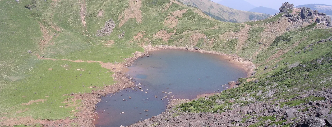
 Baengnokdam, the crater at the top of Hallasan. Seongpanak is one of only two trails that reach it. ⓒWikimedia Commons · CC BY-SA 2.5Baengnokdam, the crater at the top of Hallasan. Seongpanak is one of only two trails that reach it. ⓒWikimedia Commons · CC BY-SA 2.5
Hallasan › Seongpanak Trail (9.6 km to the summit)
Seongpanak is the longer but gentler of the two trails that actually reach the summit of Hallasan. It runs 9.6 km one way, about 4 hours 30 minutes up and roughly 9 hours for the round trip, from a trailhead already at 750 m. The gradient is forgiving almost all the way; the length is the real cost. You need a reservation for the section above Jindallaebat shelter, and that is the part most people get wrong.
Last checked 2026-09-30 · Jeju Special Self-Governing Province (Hallasan National Park Office) · Korea Forest Service trail geodata · cross-checked against the Korean edition of this page
Hallasan has five trails plus two short side routes, and this trips up a lot of visitors: only Seongpanak and Gwaneumsa go to the summit. Yeongsil and Eorimok stop at Witse Oreum and the Nambyeok junction. Donnaeko stops at the Nambyeok junction too. The Nambyeok climbing route is closed to the top because of rockfall. If you searched for a Hallasan hike and picked a trail without checking this, you can walk a full day and never see the crater.
Between the two summit trails, Seongpanak is the one to take if you are not certain about your legs. It is nearly a kilometre longer than Gwaneumsa but it climbs far more gently, and it spends most of the day in forest rather than in a deep valley. The height of Hallasan itself is quoted three ways: aerial lidar in 2016 gave 1,947.06 m, the National Geographic Information Institute triangulation point reads 1,947.269 m, and older material still says 1,950 m. This site uses 1,947 m.
The reservation does not cover the whole trail. It covers the upper section from Jindallaebat shelter to the summit. Everything below that is open walking. So if you have no reservation you can still walk the 7.3 km to Jindallaebat, about 3 hours, and turn round there without breaking any rule. What you cannot do is arrive at the shelter gate without a booking and expect to continue.
Hallasan is run by Jeju Province, not by the Korea National Park Service. That matters in practice: it does not use the national reservation.knps.or.kr system that Seoraksan and the mainland parks use, and its cut-off times are set separately. Book through the Hallasan park office and check the cut-off time for the day you are going, because it moves with the season.
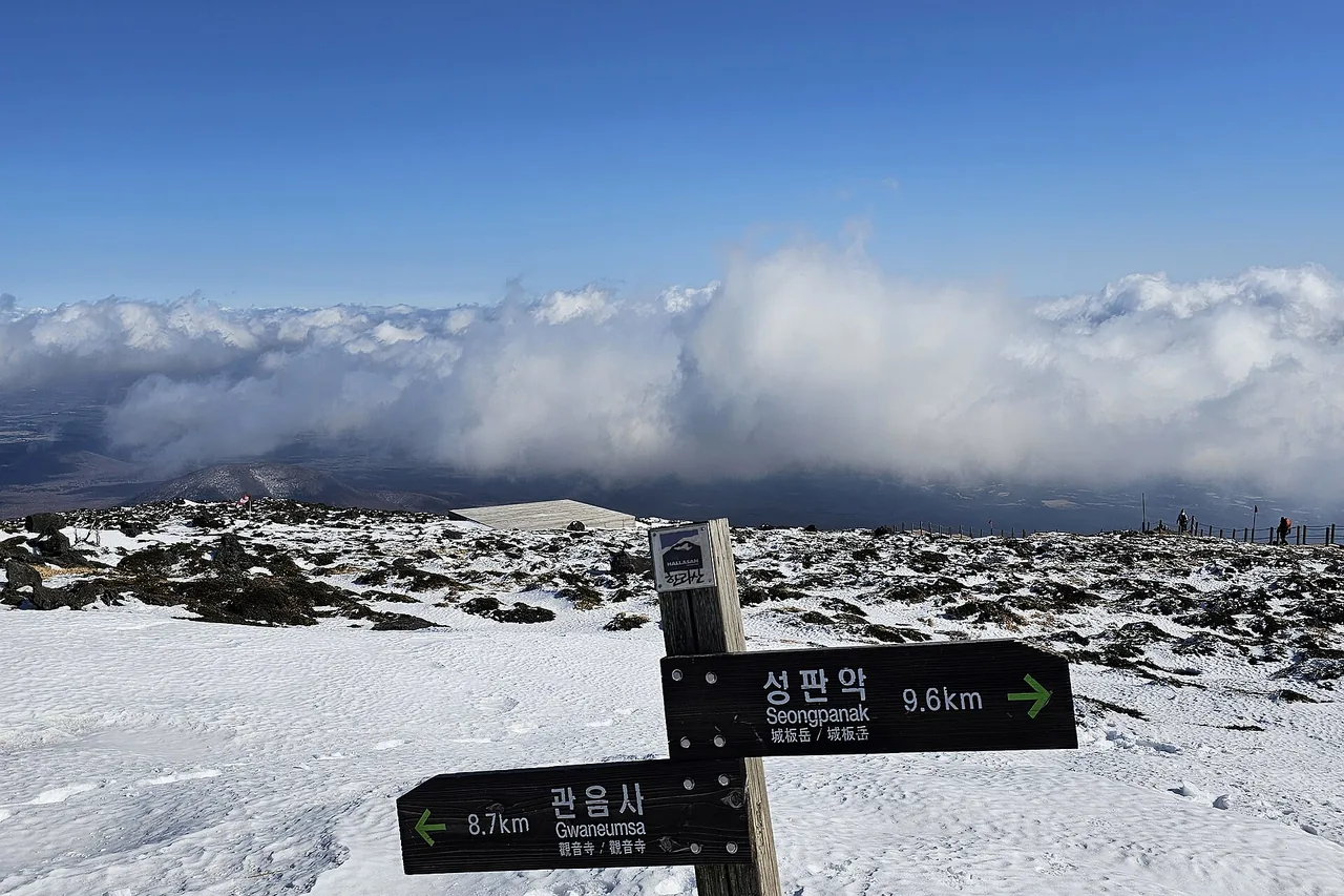
From the Seongpanak trail information centre at 750 m the path goes up through forest, past Sokbat shelter (unstaffed), the turn-off for Sara Oreum, and then Jindallaebat shelter (staffed) at 7.3 km. Above the shelter the trees thin out and the last stretch opens onto the eastern rim of the crater. Korean fir grows along much of the route, and deer and badgers are common enough that you have a fair chance of seeing one on a quiet morning.
The Sara Oreum detour is the best-value 1.2 km on the mountain. It is a separate volcanic cone with its own small crater lake and a viewing deck, it sits below the reservation section, and most people walking to the summit go straight past the junction without looking up.
Baengnokdam, the crater lake, is about 1,720 m around the rim, about 108 m deep and about 550 m across. Those figures come from provincial and press sources and differ slightly between them, so treat them as approximate. Core sampling puts the last eruption at least 19,000 years ago.
You stand on the eastern rim. You do not walk down to the water and you do not walk around the rim; both are closed. On a clear day the whole island falls away below you and the 360-odd oreum, the small parasitic cones scattered across Jeju, stand out like studs on the slope. On a normal day the summit is in cloud, which is worth knowing before you plan a trip around the view.
There is no food for sale on the mountain, and the shelters are rest points rather than huts you can stay in. A nine-hour round trip on a trail with no resupply means you carry the whole day on your back: water, lunch, a warm layer for the summit, and a headtorch if you are starting in the dark.
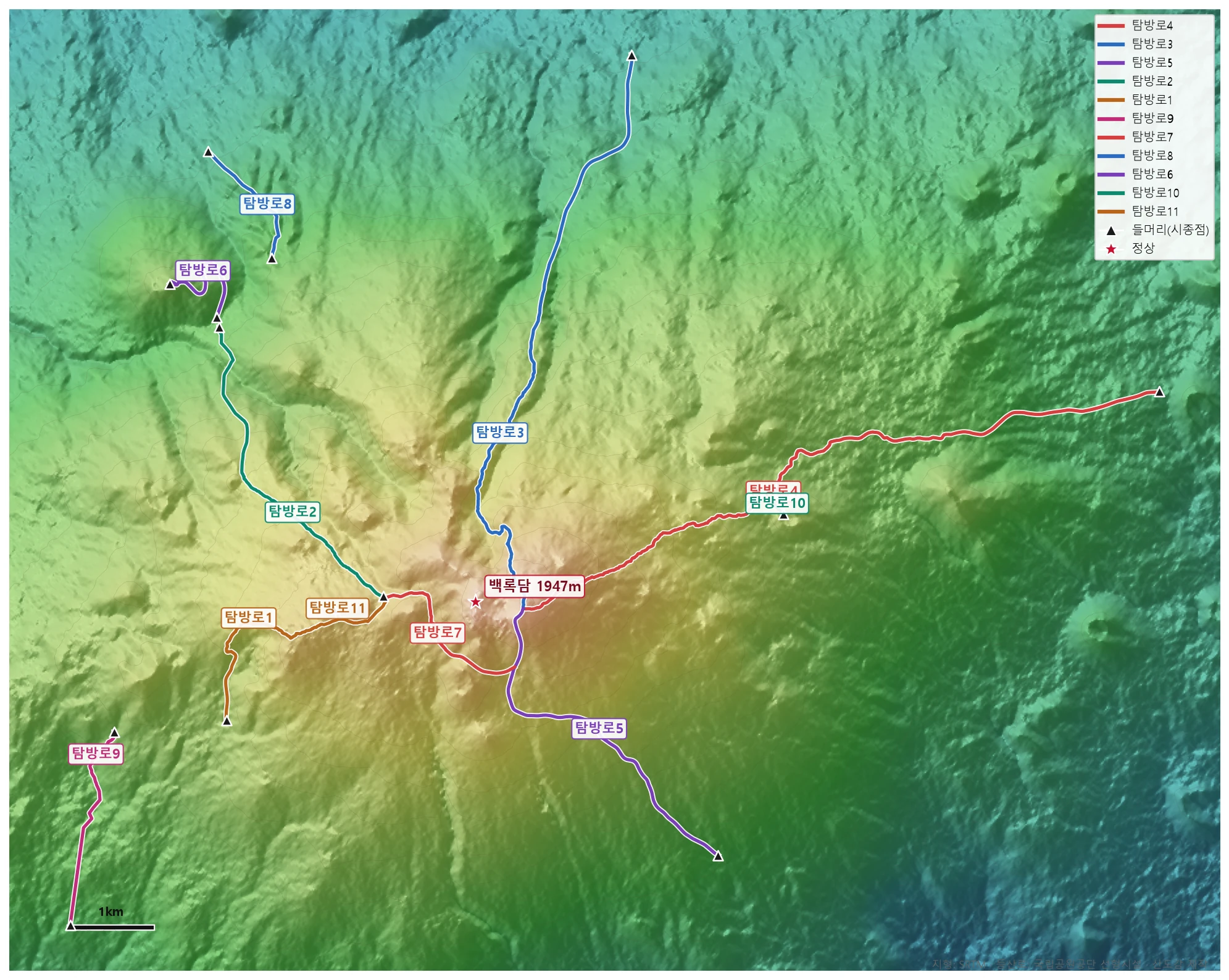
🗺 Open the full-size trail map
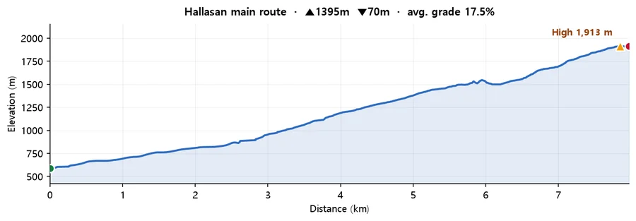
Calculated from SRTM terrain elevation (DEM) over 7.97 km. A moving average and a 4 m threshold are applied to damp GPS noise, so the figures run conservative rather than inflated. This is the mountain-wide profile for Hallasan drawn from Korea Forest Service trail geodata, not a track recorded on Seongpanak specifically. Use it for the scale of the climb rather than for turn-by-turn detail. The trail data can stop short of the summit, so the high point shown here may sit below the official 1,947 m.
For the full picture of all five trails, the reservation rules, seasonal closures and the GPX download, see the Hallasan guide. The two routes worth comparing directly with this one are Gwaneumsa, the other summit trail and the hardest on the mountain, and Yeongsil, the shortest and easiest, which does not reach the top.
Q. How long is the Seongpanak trail?
9.6 km one way to the summit, about 4 hours 30 minutes up and roughly 9 hours for the round trip. It starts at 750 m, which takes some of the climbing out of it, but it is still a full day.
Q. Do I need a reservation for Seongpanak?
Yes, but only for the upper section from Jindallaebat shelter to the summit. The 7.3 km up to Jindallaebat, about 3 hours, needs no reservation, and neither does the Sara Oreum viewpoint detour at the 5.8 km mark. Book through the Hallasan park office, which is run by Jeju Province and is separate from the national park reservation system used on the mainland.
Q. Which is better, Seongpanak or Gwaneumsa?
Seongpanak if you want the gentler day. It is about a kilometre longer, 9.6 km against 8.7 km, but Gwaneumsa climbs through a deep valley with far more elevation change and is rated the hardest trail on the mountain, at roughly 5 hours up. A common plan is up Seongpanak and down Gwaneumsa.
Q. Can I see Baengnokdam from the Seongpanak trail?
Only from the summit, and only if the cloud lifts. You reach the eastern rim and look down into the crater from there. Walking down to the water or around the rim is not allowed. There is also a second, smaller crater lake at Sara Oreum, 600 m off the trail at the 5.8 km mark, which needs no reservation.
Q. Is there anywhere to buy food or water on the trail?
No. Sokbat and Jindallaebat are rest shelters, not shops, and you cannot sleep in them. Carry everything for a nine-hour day, including a warm layer for the summit, which is considerably colder and windier than the trailhead.