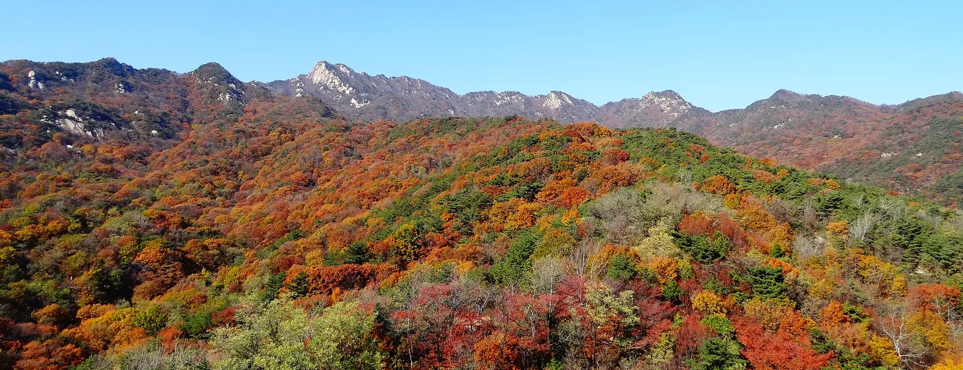
 Bukhansan from the south in early autumn. The fortress wall runs along the skyline ridge, linking the peaks. ⓒWikimedia Commons · CC BY-SA 4.0Bukhansan from the south in early autumn. The fortress wall runs along the skyline ridge, linking the peaks. ⓒWikimedia Commons · CC BY-SA 4.0
Bukhansan › Bukhansanseong Fortress (12.7 km of wall)
Bukhansanseong is a 12.7 km stone wall built in 1711 that runs along the ridgeline of Bukhansan, enclosing 6.2 km² of mountain inside it. It was put up as a refuge for the Joseon court if Seoul fell, and it is now the best long walk on the mountain: a full circuit takes about 7 hours and passes six main gates. No entrance fee, no reservation.
Last checked 2026-09-30 · Korea Heritage Service (Historic Site No. 162) · Korea National Park Service · Korea Forest Service trail geodata · cross-checked against the Korean edition of this page
Korea was invaded twice in the space of forty-odd years, by Japan in 1592 and by the Qing in 1636, and both times the court had to run. The argument that followed was simple: the capital needed a fortified mountain refuge close enough to reach in a hurry. Bukhansanseong was the answer. Construction began on 3 April 1711, in the 37th year of King Sukjong, and the wall was finished the same year.
The result is 12.7 km of stone running along the ridgelines and linking the peaks of the mountain, with 6.2 km² of ground enclosed inside it. It was designated Historic Site No. 162 on 5 December 1968. The court never had to use it. What it left behind is a walking route that happens to be one of the better ridge walks within reach of a subway station anywhere.
The name of the mountain comes from the wall, not the other way round. Bukhansan was Samgaksan, the three-horned mountain, named for the granite peaks of Baegundae, Insubong and Mangyeongdae. The name Bukhansan took hold after Sukjong built Bukhansanseong on it.
The six main gates and the three command posts are consistent across sources. The counts of secret gates (ammun) and water gates are not: Korean heritage descriptions give six and one, English-language references give eight and two. This page gives both rather than choosing, because we have not found a primary record that settles it. If you are counting gates as you walk, that is the reason your number may not match the sign.
The standard full circuit starts and finishes at the Bukhansanseong entrance on the Goyang side and follows the wall round the ridge:
None of these is a gentle stroll. The wall follows the ridgeline, which means it goes over the tops rather than round them, and a seven-hour day on Bukhansan involves a lot of stone steps. The reward is that you are on the skyline for most of it, with Seoul on one side and Goyang on the other.
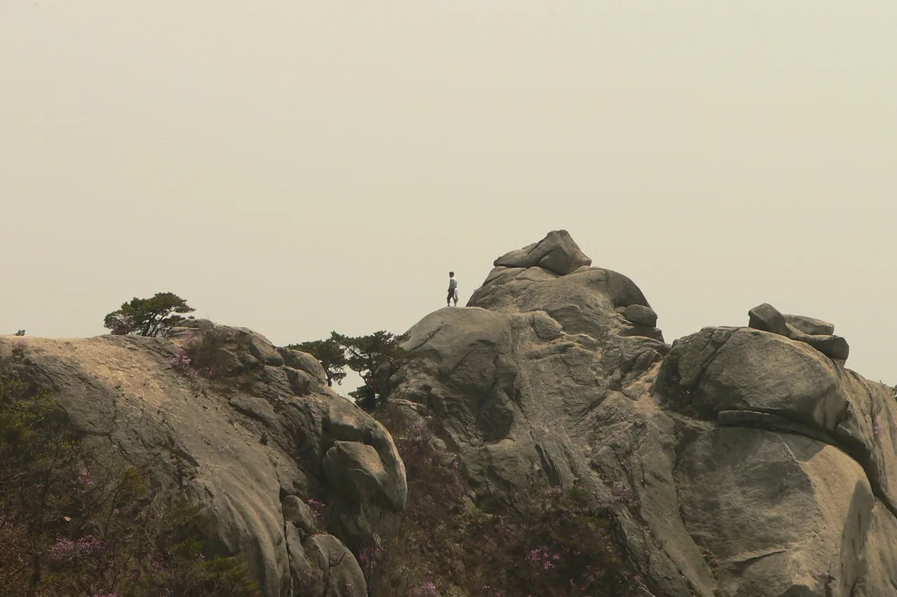
The stretch from Daenammun to Daedongmun is the piece people come for in late October. It is a high section of wall with the city visible through the gaps, and the combination of grey granite blocks, colour on the slopes below, and Seoul spread out beyond is not available anywhere else. The Korea Forest Service 2026 forecast put the national peak in the second half of October, with Seoraksan first around 20 October; Seoul is at the later end of that.
Bukhansan is the busiest national park in the country and the wall in late October is the busiest it gets. If you want the walk rather than the queue, go on a weekday, start early, or come up from the Goyang side at Hyoja-dong or Gyohyeon-ri instead of from Seoul.
The car park pricing is worth reading twice. A seven-hour circuit plus the walk in and out will put you in the all-day bracket, and at weekends the car parks are full by early morning anyway. The subway is the sensible answer on this mountain.
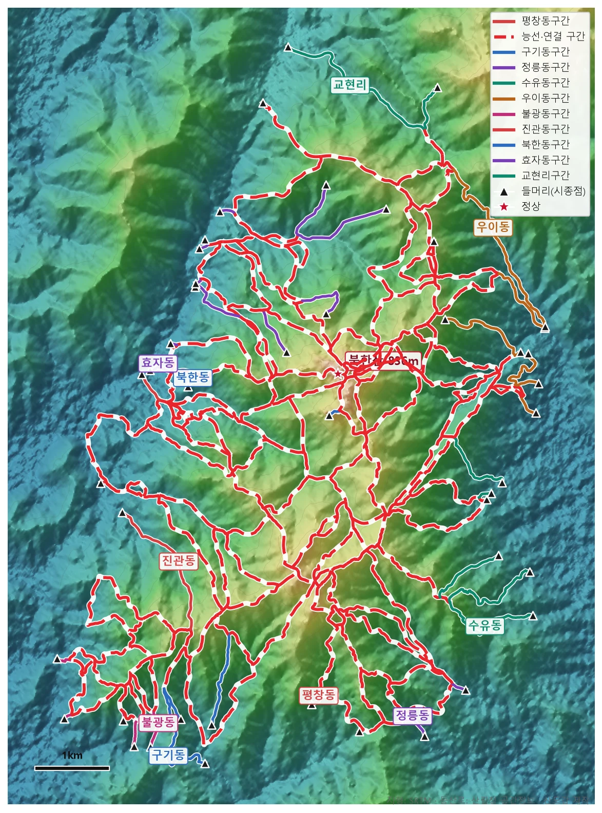
🗺 Open the full-size trail map
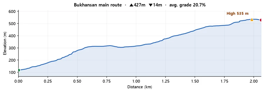
Calculated from SRTM terrain elevation (DEM) over 2.06 km. A moving average and a 4 m threshold are applied to damp GPS noise, so the figures run conservative rather than inflated. This is the mountain-wide profile for Bukhansan drawn from Korea Forest Service trail geodata, not a track recorded on the fortress circuit. Use it for the scale of the climbing rather than for turn-by-turn detail. It is built from the path with the most total ascent, so it represents the hard end of what the mountain asks.
Bukhansan National Park holds 164.9 km of trail and was designated in 1983. The summit, Baegundae at 836 m, is a separate and much shorter outing. For all the trailheads, the crowds, the seasonal closures and the GPX download, see the Bukhansan guide. There is also a 71.5 km low-level loop, the Bukhansan Dulle-gil, for days when the ridge is not appealing.
Q. How long is the Bukhansanseong wall?
12.7 km, enclosing an interior of 6.2 km². It was built in 1711, the 37th year of King Sukjong, with construction starting on 3 April, and it is Historic Site No. 162, designated on 5 December 1968.
Q. How long does the Bukhansanseong circuit take?
About 7 hours for the full loop from the Bukhansanseong entrance by way of Wimun, Yongammun, Daedongmun, Daeseongmun, Daenammun and Gasadang-ammun. A shorter option from Gugi-dong to Daenammun and back is about 4 hours 20 minutes.
Q. How many gates does Bukhansanseong have?
Six main gates, consistently: Bukmun, Daedongmun, Bogungmun, Daeseongmun, Daenammun and Daeseomun, plus three command posts. The number of secret gates and water gates differs between sources, six and one in Korean references against eight and two in English ones, and we have not found a primary record that settles it.
Q. How do I get to Bukhansanseong from Seoul?
Line 3 to Gupabal Station, then bus 704 to the Bukhansanseong entrance. If you want the southern section of the wall instead, take Line 3 or 6 to Bulgwang Station and bus 7022 or 7211 to Gugi-dong. There is no entrance fee and no reservation.
Q. Is Bukhansanseong the same as Bukhansan?
No, though the names are connected. Bukhansan is the mountain; Bukhansanseong is the 12.7 km wall built along its ridges in 1711. The mountain was previously called Samgaksan, the three-horned mountain, after its three granite peaks, and took the name Bukhansan after the fortress was built on it.
Q. When is the best time to walk the wall?
Late October for the colour on the Daenammun to Daedongmun section, which is the stretch people photograph, with Seoul visible through the gaps in the stone. It is also the most crowded time on the busiest national park in the country, so a weekday or an early start makes a real difference.